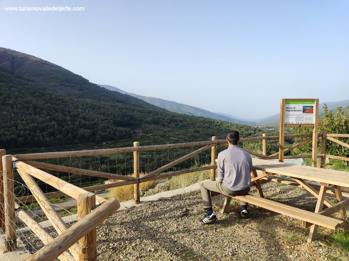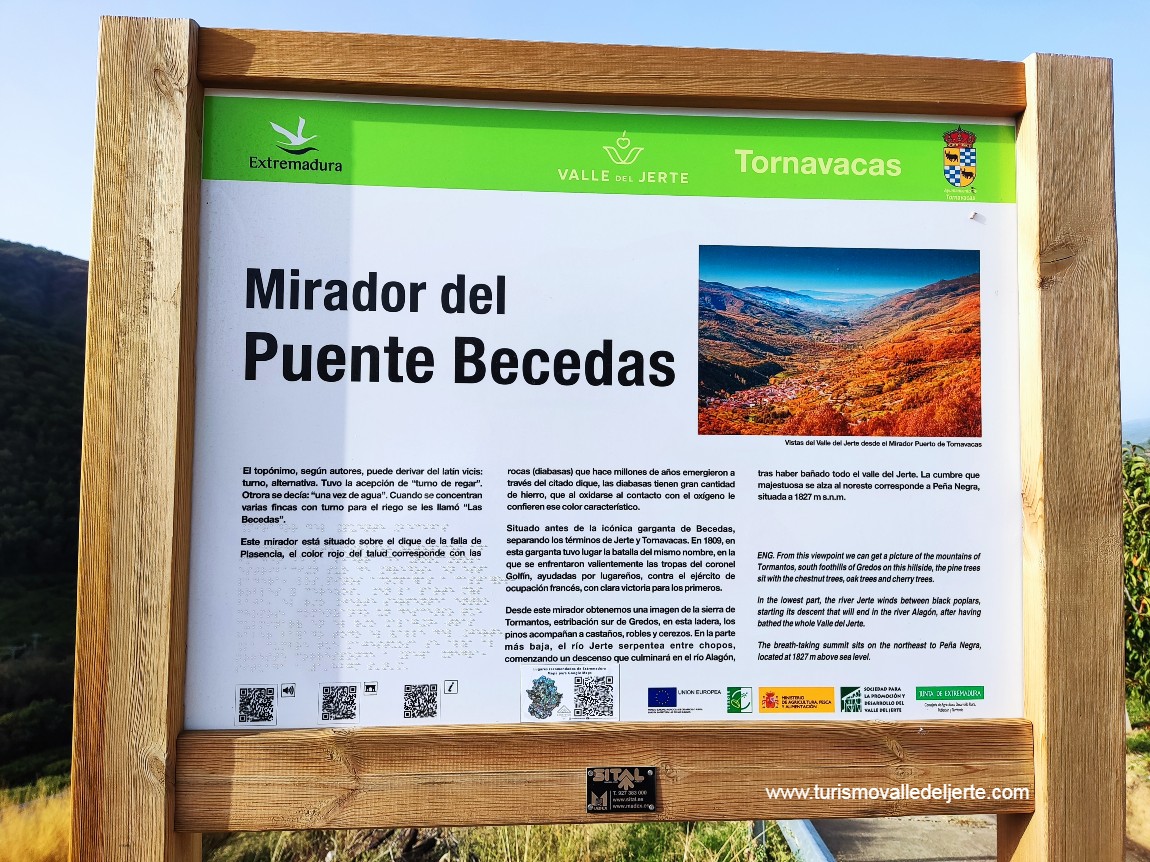
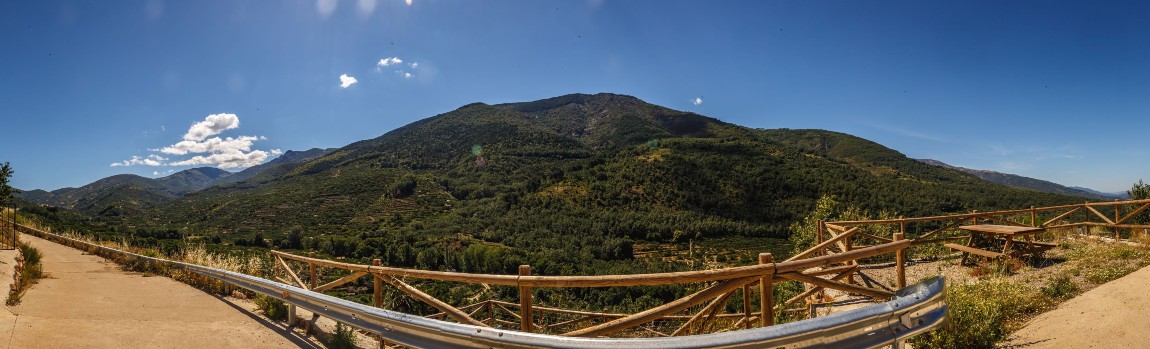
Mirador Puente Beceda
El topónimo, según autores, puede derivar del latín vicis: turno, alternativa. Tuvo la acepción de “turno de regar”. Otrora se decía: “una vez de agua”. Cuando se concentran varias fincas con turno para el riego se les llamó “Las Becedas”
Este mirador está situado sobre el dique de la falla de Plasencia, el color rojo del talud corresponde con las rocas (diabasas) que hace millones de años emergieron a través del citado dique, las diabasas tienen gran cantidad de hierro, que al oxidarse al contacto con el oxígeno le confieren ese color característico.
Situado antes de la icónica garganta de Beceda, separando los términos de Jerte y Tornavacas. En 1809, en esta garganta tuvo lugar la Batalla del mismo nombre, en la que se enfrentaron valientemente las tropas del coronel Golfín, ayudadas por lugareños, contra el ejército de ocupación francés, con clara victoria para los primeros.
Desde este mirador obtenemos una imagen de la sierra de Tormantos, estribación sur de Gredos, en esta ladera, los pinos acompañan a castaños, robles y cerezos. En la parte más baja, el río Jerte serpentea entre chopos, comenzando un descenso que culminará en el río Alagón, tras haber bañado todo el Valle del Jerte. La cumbre que majestuosa se alza al noreste corresponde a Peña Negra, situada a 1827 m sobre el nivel del mar.
VIEWPOINT PUENTE BECEDA
The name, according to authors, can be derived from Latin: turn, alternative. It had the meaning “turn to water.” Formerly said that: “once of water.” When several farms were concentrated with the turn for the watering, they were called “Las Becedas.”
This viewpoint is located on the dam of the La falla de Plasencia, a tectonic accident on a continental scale, the red slop corresponds with the rocks (diabases) that millions of years ago emerged through the dam, the diabase have a large amount of iron, upon oxidising they get their characteristic colour.
Located before the iconic gorge of Beceda, separating Jerte and Tornavacas.
In 1809, on this gorge a battle took place under the same name, in which bravely the troops of coronal Golfín, helped by the local people, fought against the French army of occupation with a clear victory.
From this viewpoint we can get a picture of the mountains of Tormantos, south foothills of Gredos on this hillside, the pine trees sit with the chestnut trees, oak trees and cherry trees.
In the lowest part, the river Jerte winds between black poplars, starting its descent that will end in the river Alagón, after having bathed the whole Valle del Jerte.
The breath-taking summit sits on the northeast to Peña Negra, located at 1827m above sea level.
Tornavacas
Long (Google Maps): -5.720394 Lat ( GoogleMaps): 40.239952